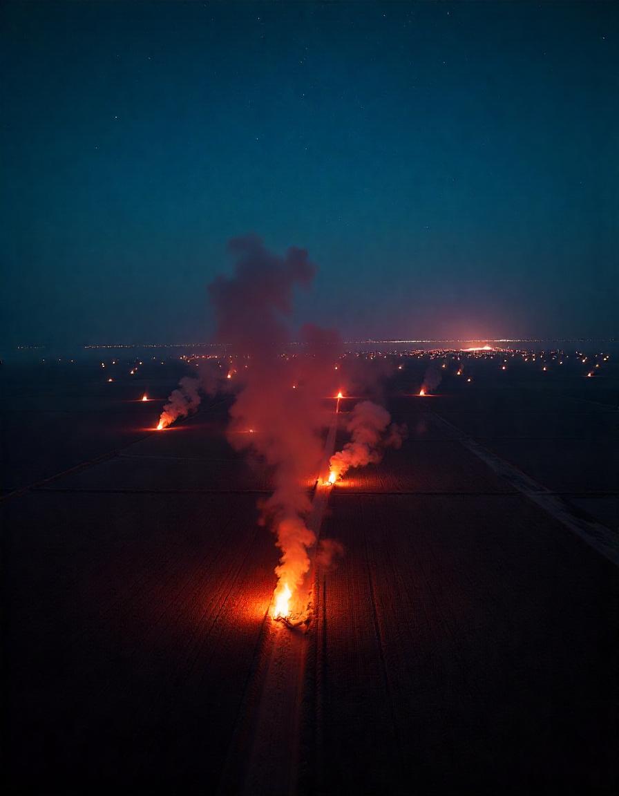
Farm Fires Data : In the past five years, Punjab’s farm fires have decreased by up to 90%, but the air quality index hasn’t shown similar improvement. Recently, the Supreme Court of India directed authorities to use geostationary satellite data for continuous monitoring of farm fires.NASA scientist Hiren Jethva also suggested in X post that farmers in both India and Pakistan may be intentionally evading satellite detection. So, let’s explore whether it’s possible to trick satellites and avoid reporting farm fire incidents.
- What Does government Farm Fires data suggests ?
- What Supreme court ordered about farm fires data ?
- What ISRO has told to CAQM about farm fires data ?
- What NASA Scientist have said about farm fires Data ?
- How Experts in India have reacted to the farm fires data?
- Difference Between farm Fire data of CREAMS and Bhuvan
- Way forward for better Farm Fire Data ?
What Does government Farm Fire data suggests ?
Government data collected by the Indian Agricultural Research Institute (IARI) and other agencies shows a significant decrease in stubble burning incidents in Punjab and Haryana. Between September 15, 2024, and November 19, 2024, a total of 27,319 burning events were reported across six states. Data indicates a significant 90% reduction in “firm fires” in Punjab in comparison to 2020 when it recorded more than 81000 cases.
What Supreme court ordered about Farm Fire Data ?
Recently during hearing on Pollution in Delhi, Supreme court of India observed that there is significant difference between Farm fires data of NASA and Korean Satellite. Apex court ordered authorities to use geostationary satellite data for continuous monitoring of farm fires and submit the data before fresh hearing on 22nd Nov.
SC has observed on 18 November hearing that
“It is pointed out that there is a difference between data collected by the stationery satellite and data collected by the polar orbiting NASA Satellite. We direct the Government of India as well as Commission to make immediate arrangements for getting data either from Korean stationery satellites or any other stationery satellites so that data of farm fires throughout the day can be made available to the states to enable them to take immediate actions. Needless to add that the commission and the central government will also involve ISRO in taking this step. Compliance on this aspect also shall be reported by this Friday. Needless to add that the commission and the central government will procure data from stationery satellites from the first of October of 2024. List on Friday when we will consider compliance with the directions issued today.”
What ISRO has told to CAQM ?
As reported by Indian Express, ISRO has wrote to CAQM that Supreme concerns are valid and they are trying further to get accurate estimate.In last hearing on 13 November, Supreme court has asked CAQM to tell the court about quality of farm fires data.
ISRO in a affidavit said that satellite like INSAT-3DR, Geo-Kompsat 2-AMI, Meteosat-9, Feng Yun-4A/4B, HIMAWARI-8 from India along with many other from country like South Korea, European Union, China and Japan are not adequate to give accurate farm fire count.
ISRO has explained that Indian satellite INSAT-3DR generate images at a frequency of 30-minute, but due to coarser resolution in comparison to Aqua Modis, these images can’t be used to accurately detect farm fire counts.
They also need to develop specific algorithms to process the raw data. Furthermore, they are lacking in availably of data and its evaluation of the accuracy as well, ISRO added. However, ISRO has hoped that they may upgrade the fire algorithms within six months.
On the point of data evaluation of Korean satellite Meterosat-9 and GK2 satellite, ISRO said they will complete the data in a month.
What NASA Scientist have said about Farm Fires Data ?
Hiren Jethva, a senior research scientist at NASA, highlighted the possibility that farmers in north-west India and Pakistan may be intentionally avoiding satellite overpasses. On October 25, Jethva posted on X and questioned that whether farmers in North West India and Pakistan avoiding satellite overpass time for stubble burning? He also that GEO-KOMPSAT 2A geostationary satellite images shows localized puffs/clouds of smoke in the late afternoon. Basically he was indicating that farmers may be timing their fires to coincide with periods when satellites are not actively monitoring the region. Later in an another post on October 28, Jethva expressed concern over the apparent inconsistency between the reported decline in stubble burning and the unchanged aerosol levels in the atmosphere.
How Experts in India have reacted to the development ?
Times of India has reported that Punjab Pollution Control Board chairman professor Adarshpal Vig has dismissed the claim of Farmers duping NASA satellites. He said that data collected by the Punjab Remote Sensing Centre—using both ISRO and NASA satellites—captures incidents of stubble burning, including those that occur at night.
“Punjab Remote Sensing Centre gathers data of farm fires from various satellites. Our data also has fire incidents at night. So, avoiding detection by satellites can be a figment of imagination of a few but not the reality.”
But then there is no credible argument against the consistent level of Aerosol Optical Depth (AOD). AOD is measure of concentration of particulates in the atmosphere. Chandra Bhushan, CEO of the International Forum for Environment, Sustainability and Technology (iFOREST) has argued that if farm fires have reduced by 80–90% compared to 2020, then then why AOD has not decreased ?
Dr Piyush Bharadwaj, an air quality scientist at Bengaluru-based Center for Study of Science, Technology and Policy (CSTEP) has said that one of the reason for low fire counts could be that the overpass satellite uses instrumentation called MODIS which has a 1 sq km pixel resolution and many farm fires are smaller than this.
Difference Between farm Fire data of CREAMS and Bhuvan
Indian govt uses data processed by CREAMS- Consortium for Research on Agroecosystem Monitoring and Modelling from Space portal which is an initiative by Indian Agricultural Research Institute. However surprisingly there is significant difference between in data of farm fire reported by CREAMS and another Indian government portal named as BHUVAN. For example, on November 19, while Punjab recorded 270 fires according to CREAMS data, the BHUVAN portal indicated 449 incidents.
Difference between satellite used by India to detect farm fires
CREMS uses a Moderate Resolution Imaging Spectroradiometer (MODIS) sensor on the Aqua and Terra satellites by NASA, while BHUVAN platform uses series of satellites which includes Cartosat-1, Cartosat-2, AWiFS, LISS-III, LISS-IV, and Oceansat-2 and BHUVAN records data more frequently that MODIS.
Way forward for better farm fire data ?
Bhushan suggested that relying on the number of reported fires as a measure of the problem may not be accurate. “A more accurate approach is to measure the total burnt area,” he proposed.
Another Expert, Gufran Beig, who is founder of the System of Air Quality and Weather Forecasting and Research (SAFAR) and chair professor at National Institute of Advanced Studies (NIAS) has advised to take help of our Indian geostationary satellites: INSAT-3D/3DR. This satellite provides continuous coverage and data in every 15–30 minutes. But it has a disadvantage too, because of coarser resolution of 3-km that may not detect scattered fire of small sizes.

